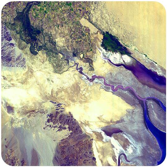
The Colorado River originates in the mountains of northern Colorado and then travels through the desert before reaching its delta at the Gulf of California. Where the river once roared into the Gulf, there is now nothing left after five states and a bit of northern Mexico use its water for irrigation and to provide water for the overgrown desert cities of the Southwest.
The river is seen in dark blue at the top left of the image. After traveling through farmlands, it fans out at the base of the mountains on the left side. The bluish purple running from left to right across the image is water from the Gulf that has traveled up the inlet since no river water fills the inlet. The river’s mouth is the bright blue horseshoe on the bottom right. The little bit of water that reaches Mexico is used by farmers near the international border. The gray mudflats were built with sediments deposited in the delta before two massive dams stopped the downstream flow of sediments. The large yellow region is the Gran Desierto, an arid, sand-covered landscape.
The distribution of water resources in the Western United States will be a topic of much discussion in the coming decades.
Courtesy of NASA?GSFC/MITI/ERSDAC/JAROS and US/Japan ASTER Science Team. earthobservatory.nasa.gov/IOTD/view.php?id=1288. Public Domain.
Candela Citations
- Earth Science for High School. Provided by: CK-12. Located at: http://www.ck12.org/book/CK-12-Earth-Science-For-High-School/. License: CC BY-NC: Attribution-NonCommercial